Sunday, November 28, 2010

Three Rivers Greenway

I headed to Columbia yesterday to ride the Three Rivers Greenway trails.  Temperature was 32 when I left Greenville, but I was counting on Columbia's legendary heat to kick in.  I hit the trail head 10:30 and temperatures had already climbed to the high 50s and were soon in the 60s where they remained throughout my ride.

Here's a map if you want to follow along
Three Rivers Greenway Map 
The Three Rivers are Congaree, Saluda, and Broad

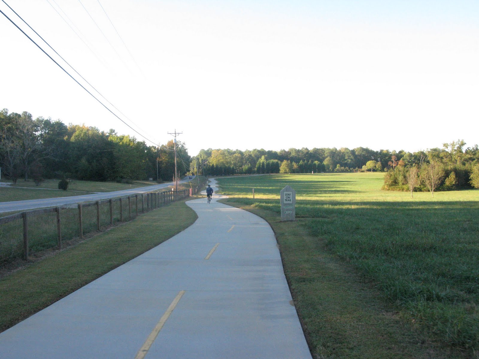
I parked at the southern end to start on the Cayce Riverwalk (parked at State and Lyles.)  The trail quickly took some tight S turns down to the river.  I explored further south to the section along Granby locks, then took another route to the main trail heading north.  I was taken aback at the construction of this trail, and it has to be one of the finest walking trails I've been on.  The Cayce section is often on boardwalks as opposed to traditional surfaces.  Lights, emergency boxes, benches, and picnic tables were liberally located along the trail.  Plenty of lookout points to take in the rocky river and even the Columbia skyline in the distance.  I rode along the Congaree River up through the West Columbia Greenway to a park under the Gervais Street Bridge.  This is a natural end to this roughly 3 mile section, and I'll proclaim again that it's a fantastic walking trail, but I'll stress the walking part.  Although acceptable as a biking trail, the trail is often narrow (5 feet?), slightly twisting, and occupied by scores of walkers and pets that congest the trail to the point of making cycling difficult.  My casual census supports this because I saw 2 other cyclists, 18 dogs, 1 Marine, and 108 people.  Don't let the last comments dissuade you from trying the trail - it's acceptable for riding and probably better in lower traffic times, and it gets better...

The trail ended at Gervais Street without clear signage as to where to go next.  In general when I did find a sign, it wasn't incredibly helpful, so bring a map.  I had a GPS and trail map and crossed Gervais to pick up the trail on the other bank of the river.  Unfortunately, the trail was closed for construction and detours were not marked.   Okay, I said it would get better, and it did.  After some frustration and map consulting, I found the trail open again at the Canal Park, and that was a really cool section.  The trail picks up on the bank of the Columbia Canal and heads north for several more miles.  The trail here is wide and the traffic more diverse.  I enjoyed crossing over the 19th century water works and riding along the banks of the canal.  The trail follows the path were horses once pulled barges.  I also liked having the calm canal waters on one side and the faster river water off to the other side.  This northern section didn't quite have the landscaping and amenities of the southern section, but it still had adequate lighting, emergency boxes, benches, and river overlooks.  The trail is probably 3-4 miles here depending on side routes or detours, but the main section is straight and level.  The trail ends at the diversion dam where you can break for restrooms and water plus some cool views of rapids and the old construction of the damn and loch.
There is another section of trail around Riverbanks Zoo, but the trails aren't yet connected and it looked a little awkward getting there via surface streets, but hopefully that section will be open on my next visit.

You'll find water fountains along the trail plus restrooms at several points.  You'll discover food options to be plentiful too just off the trail in Columbia.  Lesser options, but still nearby in West Columbia.

Despite drawbacks (narrow and congested on parts, poor signage, and construction detours), I can highly recommend this trail.  It's really well done, and the potential trouble spots can be eliminated.  I logged 15 miles and had a great day on the trail.

GERVAIS ST DETOUR: Cross River at Gervais and continue toward Columbia to Huger St.
Take Left on Huger
In roughly 4 blocks, take a left on Laurel St.
Enter trail at Columbia Canal and Riverfront Park


Trail Link's Map

Wikipedia entry for Columbia Canal

Columbia Canal

Twisting Down to the River
Example of Boardwalks - Cayce Riverwalk

Picnic Table at end of West Columbia Riverwalk (near Gervais St)
Crossing the Gervais St Bridge

Gervais St Entrance (looking down from bridge)
I Found the Trail Again - Now, How Do I Get Down There?!?

Bridge from Canal Park to Trail

Heading North From Canal Park
Northern End
View from the Dam
Looking South from the Dam
Heading Home - South Bound

Saturday, November 27, 2010

Heritage Trail - Greenwood, SC

Stare at this picture for 17 minutes


That's what it's like to ride the 2.7 mile Heritage Trail in Greenwood, SC.   The trail goes from A to B where B is nowhere.  I saw one other biker and a couple of walkers.  Really just isn't that much to this trail.  But hey, I can check it off my to do list.

Google Map of Trail

SC Trail Listing

Sunday, November 21, 2010

Greenville Pictures 11-21-10

I rode about 24 miles this morning on and around the Swamp Rabbit Trail in Greenville.  I left the house 9:15; temperature was 48.  Very light traffic this morning, but as the temperature rose (high 60s by 10:30), so did the trail users.  Great to see lots of families in addition to the serious bikers out enjoying this trail gem.

Here's a few shots:

Main Playgrounds at Clevland Park

Veteran's Memorial at Cleveland Park


Rock Quarry Garden

New Bridge Linking Cleveland Park to Downtown Sections of the Swamp Rabbit Trail.  Bridge is on schedule to be open by end of November 2010

From the Trail Bridge Just Before Going under Church St


Hard to believe this is 50 steps from bustling Main Street


Mallard Ducks playing above the falls
View from Main Street. River Place on the left bank, Wyche Pavillon on the right
Rail yard west of town. Trail runs along the tree line
You can really see how this was built on an abandoned rail line.
Old rail car where trail crosses Sulphur Springs Road


South of Blue Ridge, S.C. Highway 253


Bell Tower at Furman University


Smokestakes for the old Poe Mill behind the trains and Paris Mountain in the far background


Sunday, November 14, 2010

Rolling Razzmatazz

Preliminary dates have been set to the Rusty Rides 2011 Rolling Razzmatazz.  Stay tuned for details!

http://www.silvercometga.com/chief-ladiga-trail/index-ladiga.shtml


Maj Anderson's Plane Along Swamp Rabbit Trail (Razzmatazz and Jets Go Hand in Hand)

Atlanta

Friday I rode about 20 miles on the PATH trails in Atlanta.  I started in Decatur, went down to Freedom Parkway and back.  Sunny, warm, and very little traffic which made for a fantastic ride.

Highlights: 
 - The Martin Luther King Center
 - Late lunch at the Thinking Man's Tavern

Lowlights:
 - Crashing into back of a car

Still a little sore, so I cancelled my Sunday morning ride, but I'll try to get back on by midweek.  For everyone else, I hope you're taking advantage of this unseasonably pleasant weather.


Trail Map - I started in Decatur and headed down the southern route, then joined the northern route near Freedom Parkway and the King Center.


The King Center - Excellent site!


The Thinking Man Tavern - Tasty burger, Cool Patio


Atlanta Skyline from Freedom Parkway Trail


Eternal Flame at King Center


Thursday, November 11, 2010

McQueen's Island Historic Trail

Most of my rides this fall revolved around football games, and that's been a good excuse to try new trails.   I was actually in Savannah, Georgia November 6th for a non-football weekend and took the bike along.  Ms. Rusty and I parked at Fort Pulaski and rode the six mile McQueen Island Historic Trail.
( @bpitch1 was scheduled to join us but had a GPS incident.)

The Savannah & Atlantic Rail Line was built in 1887 to link Savannah to Tybee Island.  After a highway was constructed 1923, the railroad was abandoned.  Locals took the abandoned line and created the McQueen's Island Historic Trail.  The trail runs three miles roughly parallel to U.S. Highway 80 and another 3 miles through the marshes along the Savannah River.  The trail is packed gravel and completely flat.  Numerous benches and picnic tables line the trail, and there's a portable toilet around the midway point.
The marsh and river are beautiful.  Signs indicated all the wildlife to be seen, but on our November ride, we only saw birds and fiddler crabs.

I've thought about the ride for almost a week now, and I haven't been able to get excited about this trail.  I though the surface was good, but Ms Rusty considered it too rough.  The scenery was amazing, but I didn't feel like biking added anything to the enjoyment and hiking would have probably been a better way to enjoy the trail.  It was sunny but windy and cool (cold?) when we rode.  That didn't help my enjoyment, and I can even imagine insects, heat, and humidity being an issue for most of the year.  Ms Rusty liked the trail, but I felt it just lacked something.  @bpitch1 rode the day after us, and he captured what I was struggling to express.  He rode a few miles, and then turned around saying he was cold and the trail was just boring.  Nothing changed -flat, straight, same scenery mile after mile.  The trail is okay, but I would have enjoyed the bike paths and historic districts around Savannah better.  Perhaps the locals enjoy McQueen's Island Trail for a different look, but to me, it's just okay.  But if you're in the area, try the trail and let me know what you think.


The link's information is a bit outdated.  The trail has been fixed and is back to a full 6 miles, but the review accurately hits on the other basics.
Trail Link Review and Maps


Yes, the scenery is beautiful!


Erosion is an ongoing concern


End of the Trail


Sunday, October 17, 2010

Lucky Man

I'm lucky to ride the Swamp Rabbit Trail weekly, and I've been even luckier to discover more trails that are at least its equal. Rode another great one yesterday (Mt Arabia in Georgia) and can't wait to find some more!

Any favorites?

Friday, October 15, 2010

Swamp Rabbit - Detour Note

The buildings flanking the only gravel portion of the Swamp Rabbit Trail just north of Furman are being torn down, and a detour is set up through November.  The detour is hilly and crosses a major road.  I advise against children tackling it.   Good news is the trail will be fully paved when this project is complete!

The Bramlett Road section is still closed (although that doesn't stop the vast majority of folks from pedaling through), but the County is taking bids for to reroute the trail and install train signals.  The detour actually isn't bad and can be seen in this video.
Bramlett Rd Detour

Happy Trails!

Tuesday, October 5, 2010

Atlantic & Yadkin Greenway Greensboro, NC

Last Saturday, I was in Winston-Salem for the Wake Forrest-Georgia Tech football game.  I researched nearby trails and was thrilled to find the Greensboro Trail System about 30 minutes away.  Reviews were great and the weather forecast may have been even better.  The trail nor the weather disappointed.  I rode with @BPitch1 who declared the Atlantic & Yadkin Greenway to be the best trail he's ever ridden.
The trail's listed at 7.5 miles, but I don't think that includes a new section opened this year.  Up and down with a few side trips, we logged 19.5 miles. We met some friendly locals who told us plans are in the works to extend the trail several miles to downtown Greensboro.  The trail surface was good and the terrain was varied.  You pass through developed suburban areas, neighborhoods, lakes, and forests.  The trail was slightly hilly, but I found the hills to be fair.  The long climbs were gradual, and the little downhills were really fun.
Guilford Courthouse National Military Park is near the southern end of the greenway, and this could be a destination itself.   The trail skirts the Guilford Revolutionary War site and heads north across Lake Brandt and past Bur-Mil Park.  Numerous hiking and mountain bike trails intersect this route.  Both the parks are beautiful with picnicking spots, parking, water stations, and restrooms.  Two railroad bridges cross serene Lake Brandt and allow you great looks at local wildlife.  I saw several turtles, birds, and chip monks.
We parked at Country Park just south of the Guilford Courthouse Park.  The online map showed this to be very near the trail's southern terminus.  We pedaled north and saved the small southern part for the return trip.  We were so glad that we finished the ride heading south beyond the parking area because there's a recently added trail section that's not listed on many guides, and this section cuts right behind some good dinning options, specifically Stamey's famous barbecue.  Stamey's has set the standard for Hickory-style barbecue since 1930, and I recommend you stopping in for a sampling of their smoked pork with spicy vinegar sauce.  The barbecue coleslaw is a real treat too.  If you road hard, you've earned ice cream and peach cobbler so save room!
All in all, this is one of the most fun rides I've had (the Fall foliage and 60-70 degree temperature didn't hurt).  Definitely a destination ride, and I hope you'll give it a try.  Hotels and shopping are plentiful.  I think my next visit may include a day of biking, then another day of hiking.

Greensboro Parks & Recreation Trail Page

Atlantic & Yadkin Greenway Description

Atlantic & Yadkin Map

Guilford Courthouse National Military Park

Bur-Mil Park

Herbie's Place (Breakfast All Day)

Stamey's Barbeque

Greensboro Visitor's Bureau


Heading north from Country Park

Northern Section of Trail
Trail as seen from Bur-Mil Park


Fun Downhill with Curve

Lake Brandt from Rail Road Bridge
Parking at Guilford Courthouse
New Section Near Southern End of Trail


Monday, September 20, 2010

North Augusta Greenway Trail

I was in Columbia, SC Saturday for the USC-Furman game and decided to stay the night and take in a trail Sunday morning.  The Rails to Trails guide hide nice things to say about the North Augusta Greenway Trail, so I drove about 45 minutes and gave it a try. 
The trail was listed at less than 5 miles, and I thought I may have to ride it both ways a couple of times to make the trip worthwhile, but there have been some welcome to the changes since the Rails to Trails review. I measured the trail at 5.2 miles, and there's a fairly recent addition, the Riverfront Greenway, that adds another 1.6 miles.  Up and back, plus the loop, and some side riding, and I easily logged 12 miles.  The Greenway trail is a well maintained asphalt surface about 10 feet wide and well shaded.  The Riverfront loop is concrete and out in the open a bit more.  The Greenway opened in 1995.  I didn't see a date for the Riverfront, but the surface looked new and there were sings of ongoing construction.
Temperature was mid 80s in the parking lot but immediately dipped on the trail.  I started at the north entrance where the trail cuts between neighborhoods.  The first couple of miles are peaceful pine forest. After 3 miles, the trail transitions to parks and ball fields while maintaining a shade canopy. Benches and water fountains are plentiful, but I didn't see a restroom until the soccer complex about 4 miles in.  There is an extensive recreation complex after 3 miles, and there may be some facilities there, but I didn't see anything directly on the trail.  Traffic was light (10 Sunday Morning), and the trail is perfectly safe for children.  I can see my 4 year old son handling it easily.  All of the major rodes are crossed via bridge or tunnel, so it's really safe.  There is a slight grade South to North, but it's slow and steady, nothing to kill you; however, there is a bit of a hill on the Riverfront loop to get down to the water.
I really loved this trail, and it's such a great resource for those in the Aiken-Augusta area.  I didn't think the Greenway would be a destination trail but after exploring the area a bit more by car, I'm going to make this a definite go to trail.  Downtown is just uphill from the south end of the trail, and there's several restaurants and shops worth popping in.  The real treat is hitting the surface streets and heading over to Augusta, GA (<2 miles).  I wouldn't recommend this for children, but even a novice adult could make an easy go across the river.   Downtown Augusta has even more to offer than it's sister to the north including the Augusta Canal Trail.  I'll save that review for later, but the Canal trail is about double the length of the Greenway.  Put together, the North Augusta Greenway Trail and Augusta Canal Trail make for a full day of riding.

The North Augusta Greenway Story

North Augusta Greenway Trail Listing with Map Links

Rails to Trails Link (free registration required)

North Augusta Chamber of Commerce

Augusta Visitors Bureau

Augusta Canal
Smooth and Shaded
Because I Like Bridges

South End Trail Head
Example of Good Trail Signage - North Entrance

Tunnel Under Busy Road

Riverfront Greenway Trail