I started playing around with Pinterest and here's my first attempt at a Board about the Swamp Rabbit Trail.
Pinterest - Swamp Rabbit Trail
My Cycling Journal - Published for those interested in trying new trails. I'm based in Greenville, SC, and if there's a trail within a half day's drive, I plan to ride it.
Sunday, December 23, 2012
Friday, September 7, 2012
Impromptu Ride in Music City
Fall is my busiest time of year. As football season cranks up, I find myself on the road most weekends cheering on the mighty Georgia Tech Yellow Jackets. For the last couple of years, I've combined football getaways with bike rides as much as possible and have experienced many new trails. In addition to following Georgie Tech in Atlanta and select road games, I try to join my brother in Columbia once a year for a South Carolina game. These trips have yielded some pleasant rides such as riding in Columbia to the tailgate, exploring the Three Rivers Greenway, and a detouring to the nearby North Augusta Greenway. My schedule didn't allow for a game in Columbia this year; however, I received a special invitation to join my brother and two old friends in Nashville for a South Carolina - Vanderbilt game. With the promise of S.E.C. football, live music, and a chance to catch up with old friends, my answer was a quick yes!
The gang picked me up late Wednesday morning, and we headed out on a six hour drive to Nashville, TN. We checked in around 4:00 local time and headed down to Music Row and the honky tonks on Broadway. We lucked into prime seats just feet from the stage at Tootsie's Orchid Lounge. After catching a full set from Jake Maurer and his band, we took off for a night of music, catching a song or two in just about every spot on Broadway and a few spots off off Broadway. After a picture with an Elvis impersonator, we capped the night off with a gourmet Southern meal at Merchants.
After breakfast the next morning, I took my coffee to go and explored the area immediately around our hotel. It was Thursday in Nashville, a work day for most, and I noticed the people waiting at the bus stop, and then I noticed the bike racks on the buses, and then I noticed bike commuters, and then I noticed a greenway, and then, I knew what I was going to do. I was going to find a bike shop and explore the city by bike! When I pulled up Google, the first result was for a Bike Share, and there just happened to be a stop just 5 blocks from the hotel. I encouraged my travelling companions to join me, but they saw no need to bike when there was plenty of gas in the S.U.V. Undeterred, I headed out solo. I'd never used a bike share and wasn't sure what to expect, but I had cash and was excited to get moving. And the day got better. The bike share was free. And not only free but a nice bike with fenders and a basket. My goal was recreational, but the Nashville Bike Share provides a valuable transportation option for its citizens. I met a gentleman who didn't drive and used the bike to fill his prescriptions. My new friend headed off to the drug store, and I headed down the Music City Bikeway. I didn't have a plan nor a map, but the bikeway was well marked, and maps were posted frequently along the route.
Greater Nashville is home to several greenways and many miles of bike paths. I started at the Riverfront Transit Station (Broadway and 1st,) and followed the Music City Bikeway north past city hall and out of downtown. The Cumberland River was to my right. I could see LP Field across the river and several barges docked along the bank. The trail quickly left the skyscrapers and turned through a working river front district with storage tanks (grain and fuel,) concrete plants, and docks. The Music City Bikeway turned inland, but I took the fork right and continued along the waterfront on the Cumberland River Greenway. The trail was gravel but being paved and ran along the levy beside the bends of the Cumberland River. I rode this a couple of miles, crossing under I-65, enjoying the river while dodging the paving crews. When I turned around, I was struck by the Nashville skyline in the distance. I pedaled back toward the city and took a slight detour on the Morgan Park Bikeway which ran about half a mile and joined Morgan Park and its surrounding residences to the main bike network. I noticed later online that the Nashville Bike Network has many spurs such as this that make for a more robust, connected bike transportation system. I've enjoyed many linear park type greenways, but by branching out from a main line, Nashville's system is more functional that those others. Back to the Cumberland Bikeway and then to the unexplored fork of the Music City Bikeway. This area had a nice mix of office, light industry, and residential development. After about half a mile, I came to Tennessee's Bicentennial Capitol Mall State Park and adjoining Farmer's Market. I enjoyed a few minutes looking around here at the monuments and landscaping. The state Capitol rose impressively on a hill several blocks away. After the Mall, the Music City Greenway took to the streets ,mostly bike lanes but an occasional sharrow. I felt quite safe and rode maybe another mile in traffic before heading back to the transit station. Later that night as I tailgated by Centennial Park near Vanderbilt, I learned from many passing cyclists that I was probably less than a mile from where the Music City Greenway joins up with the Vanderbilt area. With some better planning, I could have scoped out the campus and surrounding areas before the game. But the morning ride was a success, and I turned the bike in after 2 hours with 11 miles logged. Nashville has quite a bit going on with bike infrastructure, and I hope to visit again soon to explore the rest of their network.
And if you're wondering, South Carolina pulled out a close win over Vanderbilt.
Walk / Bike Nashville
Nashville Greenways
Nashville Green Bikes / Bike Share
Singer Jake Maurer
 |
| Well Marked Routes |
 |
| Freshly Paved Trail on the Cumberland River Greenway |


 |
| City Bus with Bike on Front Rack |
 |
| Centennial Mall |
 |
| Heading South Toward Downtown Nashville |
 |
| Cyclists Finishing a Twilight Ride on Broadway |


 |
| My Friend Lilly Pad courtesy of Regions Bank and Nashville Bike Share |
 |
| Informative Maps Placed Frequently Along Nashville's Greenways |
 |
Jake Maurer
|
 |
| Riding With the King |
Monday, July 23, 2012
Swamp Rabbit Trail - South at Lake Conestee
I'm lucky to live near one of the great trails in the Southeast: Greenville County's Swamp Rabbit Trail. This 14.5 mile gem runs from North Greenville Hospital, through downtown Travelers Rest, behind Furman University, through Greenville's Textile Belt, into downtown Greenville, Falls Park, Cleveland Park, and past Greenville Tech. Hundreds of thousands of neighbors and visitors join me on this trail for recreation and transportation. Here's a basic overview from Greenville Recreation District http://greenvillerec.com/parks/swamprabbit/
Planning continues to enhance and grow the trail through neighborhood connecting trail spurs and by lengthening the main trail itself. Through efforts of the Lake Conestee Foundation, Greenville Hospital System, Greenville Rec, and ReWa (Water/Sewer Authority,) riders and walkers already have access to a great 4 miles of trails south of the city around Lake Conestee. There's great hope to join this section to the main trail over the coming years, and citizens and their elected representatives are looking at the best route that makes economic sense and protects private property values. For lack of a better name, I call this section Swamp Rabbit Trail - South, and until/if it joins the main trail, it will stand alone as a desirable, destination activity. Yesterday I treated myself to a ride down South.
I parked at the southernmost trail head where the old mill stands. The Reedy River was dammed here, creating Lake Conestee. This link covers the history if you're interested in reading more.
http://conesteepark.com/history
Although surrounded by homes, Lake Conestee is sheltered enough for one to immerse in the natural beauty. Migratory birds, reptiles, and small mammals abound in the area. It's not surprising to see a dozen species of birds, turtles, squirrels, and rabbits on any visit. I drove down yesterday for a bike ride, but on many of my visits, I take advantage of the multiple hiking trails.
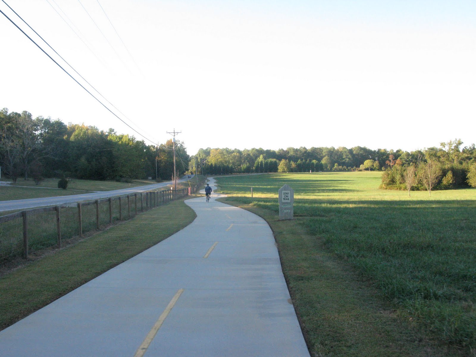
From the starting point by Conestee Mill, you take the trail north, down to lake level and follow its undulating path through Lake Conestee Park. There are a few forks, but the route is well marked. At 1.9 miles, you come to another trail head/parking lot in the Augusta Acres neighborhood. The Swamp Rabbit takes to surface roads here up to the 2.5 mile mark. The road route is well marked and car traffic light. While the Lake Conestee portion is undulating, this next section is just plain hilly. Whatever you're lowest gears, you'll need them. Stay on the trail and enjoy the scenery. You'll cross the Reedy River at about the 3.2 mile mark. The trail goes from asphalt to packed sand here, but the surface is well maintained and pleasant to ride on. At 3.5 miles, you'll see the ReWa fencing and enter the heart of the water treatment area. A boardwalk leads over scenic wetlands filled with cattails. At 3.8 miles you go under Mauldin Rd beside the Reedy River and the ReWa headquarters. The trail rises up to parallel Parkins Mill Rd where it ends under I-85 at the 3.9 mile mark. I turned around, and after exploring a little on the side, I returned to the car with 9 miles under my belt. The solid hour ride with the hills and sights was a perfect mind cleanser and a phenomenal way to end the weekend.
Google Bike Map of Greenville,SC (Showing Main & Southern Sections of the Rabbit)
The darkest green is the Swamp Rabbit Trail
Lake Conestee Maps
There are generally maps available at the trail heads, but you can download you're own detailed map here.
Planning continues to enhance and grow the trail through neighborhood connecting trail spurs and by lengthening the main trail itself. Through efforts of the Lake Conestee Foundation, Greenville Hospital System, Greenville Rec, and ReWa (Water/Sewer Authority,) riders and walkers already have access to a great 4 miles of trails south of the city around Lake Conestee. There's great hope to join this section to the main trail over the coming years, and citizens and their elected representatives are looking at the best route that makes economic sense and protects private property values. For lack of a better name, I call this section Swamp Rabbit Trail - South, and until/if it joins the main trail, it will stand alone as a desirable, destination activity. Yesterday I treated myself to a ride down South.
I parked at the southernmost trail head where the old mill stands. The Reedy River was dammed here, creating Lake Conestee. This link covers the history if you're interested in reading more.
http://conesteepark.com/history
Although surrounded by homes, Lake Conestee is sheltered enough for one to immerse in the natural beauty. Migratory birds, reptiles, and small mammals abound in the area. It's not surprising to see a dozen species of birds, turtles, squirrels, and rabbits on any visit. I drove down yesterday for a bike ride, but on many of my visits, I take advantage of the multiple hiking trails.
From the starting point by Conestee Mill, you take the trail north, down to lake level and follow its undulating path through Lake Conestee Park. There are a few forks, but the route is well marked. At 1.9 miles, you come to another trail head/parking lot in the Augusta Acres neighborhood. The Swamp Rabbit takes to surface roads here up to the 2.5 mile mark. The road route is well marked and car traffic light. While the Lake Conestee portion is undulating, this next section is just plain hilly. Whatever you're lowest gears, you'll need them. Stay on the trail and enjoy the scenery. You'll cross the Reedy River at about the 3.2 mile mark. The trail goes from asphalt to packed sand here, but the surface is well maintained and pleasant to ride on. At 3.5 miles, you'll see the ReWa fencing and enter the heart of the water treatment area. A boardwalk leads over scenic wetlands filled with cattails. At 3.8 miles you go under Mauldin Rd beside the Reedy River and the ReWa headquarters. The trail rises up to parallel Parkins Mill Rd where it ends under I-85 at the 3.9 mile mark. I turned around, and after exploring a little on the side, I returned to the car with 9 miles under my belt. The solid hour ride with the hills and sights was a perfect mind cleanser and a phenomenal way to end the weekend.
Google Bike Map of Greenville,SC (Showing Main & Southern Sections of the Rabbit)
The darkest green is the Swamp Rabbit Trail
Lake Conestee Maps
There are generally maps available at the trail heads, but you can download you're own detailed map here.
 |
| Wetlands just north of Lake Conestee |
 |
| Markings where hiking tails cross the Swamp Rabbit Trail |
 |
| Handy directional arrows |
 |
| Current end of trail at I-85 and Parkins Mill Rd |
 |
| Directional arrows on Trail and Roads |
 |
| Hillssssssssssssss!!!!!!! |
 |
| 3 Picnic Tables Sit Beside the Tail Close the Augusta Acres Trail Head |
 |
| Wetlands view from the ReWa boarwalk (Water Treatment Facilities in the Distance) |
Monday, July 2, 2012
Westside Aquatic Center from the Swamp Rabbit Trail
I wanted to share this, and it was too big for a Tweet. In his recent newsletter, @SwampRabbitTy passed along directions from the Swamp Rabbit Trail to the Westside Aquatic Center
This is an easy ride, and it's a fantastic facility. Call ahead for details (864-679-7946) or check the website http://greenvillerec.com/westside
Looks like free afternoon cool downs for the next two days.
Google Map (Directions)
Have fun, stay cool, and be safe
Rusty
I wanted to share this, and it was too big for a Tweet. In his recent newsletter, @SwampRabbitTy passed along directions from the Swamp Rabbit Trail to the Westside Aquatic Center
"From the GHS Swamp Rabbit turn west on to E. Bramlett and stay straight until you get to West Blue Ridge Dr. Take another left onto West Blue Ridge Drive and Westside Aquatic Center will be just down the street on your right (2700 West Blue Ridge Dr.) Only 1.3 miles or a 9 minute bike ride from the trail!"
This is an easy ride, and it's a fantastic facility. Call ahead for details (864-679-7946) or check the website http://greenvillerec.com/westside
Looks like free afternoon cool downs for the next two days.
Google Map (Directions)
Have fun, stay cool, and be safe
Rusty
 |
| Cooler Days |
Tuesday, June 19, 2012
She Said Greenville Doesn’t Need Bike Lanes
I haven’t ridden any new trails lately, but I have one in the works and plan to revisit a few this summer. I’ve found my cycling pattern has changed quite a bit over the last year. I’ve gone from a couple of long rides a week to several short rides throughout the week. I’ve also found myself more on streets and less on greenways. I’m still reconciling how I feel about this change. I do like starting the day off with a bike commute, but I love the greenways so much that I’m going to make a point of hitting them more and setting a more aggressive schedule for visiting new ones.
So today’s post isn’t about trails, but instead is about a bike lanes in Greenville

She Said Greenville Doesn’t Need Bike Lanes
A friend at work bought a bicycle, and he asked me about the Swamp Rabbit Trail. He lives in Anderson
“I don’t know why we have bike lanes. Nobody uses them.” Boy, I stewed on those words for days. People are in the bike lanes daily. I’m one of those people! I see other people. Just this morning on my ride in to work, I passed three other cyclists in a mile on the
E. North St
bike lanes.. Four of us on a random Tuesday morning. Of course people use the bike lanes. As more bike lanes are added, we see more people using them. We have data from year one of the Swamp Rabbit Trail that shows the vast majority of people drive to a trail head to bike. Year three is shaping up differently. Sit downtown on a given day, and you’ll notice people using the bike lanes. Come downtown on a weekend, and you’ll see people riding into town for lunch and a ride on the Swamp Rabbit. It’s getting to the point where more and more people are comfortable riding a few miles to the trail instead of loading the bikes on the car.
My colleague was wrong about bike lane usage, but she did have a point worth discussing. Why have bike lanes? I see two main reasons.
1) City Planning should be proactive not reactive (Maybe that’s why it’s called ‘planning’) Infrastructure has to be in place before people use it. I have several friends who ride recreationally, but they’re not ready to use a bike for daily trips because they don’t feel comfortable on busy roads. Once the infrastructure is in place, they will have the option of biking to the drug store, to school, to restaurants, and to work. But the infrastructure must be in place FIRST.
2) People want bike lanes and cycling paths. Greenville
Main Street
, Falls Park Greenville
Sunday, April 22, 2012
Mill Town Ride : Chattahoochee Valley Rail Trail
Along the Alabama/Georgia border lies a town named Valley. The nearby Chattahoochee River nurtured the crops and powered the mills. Labor here was cheaper than England, then later, cheaper than New England. The mills came for the labor and the ready access to their raw materials. The men, women, and children came to the mill from the fields because the farm was harder and more uncertain. The mill with its village, school, and company store promised stability.
The mills are gone. The train tracks that took the finished goods to markets around the world were abandoned.
The train tracks have been reclaimed into a recreational trail. Despite the searing South Alabama heat, folks walk it and bike it. It's a good way into town; a good place to run into a neighbor; a good place for a visitor to ride and think.
___________________________________________________________________________
I was south of Atlanta for a long weekend, and as I often do, I consulted Trail Link for a nearby trail. Trail Link is an invaluable starting point, and the user comments keep the listings relevant with updates and tips.
Chattahoochee Valley Rail Trail
7 miles seemed like a nice trail to double up on and get a nice 14 mile ride in, so I loaded up the family and made the hour and a half car ride. Many of the Trail Link comments focused on the difficulty of connecting the 2 sections of the trail, and I too found this to be true. The Southern portion is easy enough to find, but the Northern section is across a confusing and busy intersection that is not easily accessible by bike (nor its location readily apparent.) From the Southern section, look across the street toward city hall. The Northern section starts across the field at the road in front of the city hall property.
North Section:
Start at City Hall 20th Ave at 23rd Blvd and head north. This section is only a mile and can easily be skipped except 1) it's a good route to the restaurants near the interstate 2) it ends in a mill village, and the city planning dork in me loves the symmetric, grid layouts of a mill village.
South Section:
The South Sections is a lot of fun. We started at 59 St in the old Langdale Mill parking lot. The trail rolled gently as it paralleled US 29 for about a mile and a half. After turning away from the highway, the trail ran by Sue's Chic Cafe a few blocks on. It was too early for lunch, and too late for breakfast, but based on the traffic and people lingering in the parking lot, this is the place to gather in town. There's a Y in the trail about 4.1 miles in, and I missed it heading south. I only noticed it after we turned around at the end. The Y goes downhill through a park, and is a nice addition for mileage and for a fast descent. The pedaling back up is real, but at least it's shaded!
I logged 16.2 miles. With a stop in a park and another with some locals beside the trail, it was a good 2 hour ride.
If you're in area, stop into Valley and enjoy their rail trail.


Note: Trail Ridden 9/2/11
The mills are gone. The train tracks that took the finished goods to markets around the world were abandoned.
The train tracks have been reclaimed into a recreational trail. Despite the searing South Alabama heat, folks walk it and bike it. It's a good way into town; a good place to run into a neighbor; a good place for a visitor to ride and think.
___________________________________________________________________________
I was south of Atlanta for a long weekend, and as I often do, I consulted Trail Link for a nearby trail. Trail Link is an invaluable starting point, and the user comments keep the listings relevant with updates and tips.
Chattahoochee Valley Rail Trail
7 miles seemed like a nice trail to double up on and get a nice 14 mile ride in, so I loaded up the family and made the hour and a half car ride. Many of the Trail Link comments focused on the difficulty of connecting the 2 sections of the trail, and I too found this to be true. The Southern portion is easy enough to find, but the Northern section is across a confusing and busy intersection that is not easily accessible by bike (nor its location readily apparent.) From the Southern section, look across the street toward city hall. The Northern section starts across the field at the road in front of the city hall property.
North Section:
Start at City Hall 20th Ave at 23rd Blvd and head north. This section is only a mile and can easily be skipped except 1) it's a good route to the restaurants near the interstate 2) it ends in a mill village, and the city planning dork in me loves the symmetric, grid layouts of a mill village.
South Section:
The South Sections is a lot of fun. We started at 59 St in the old Langdale Mill parking lot. The trail rolled gently as it paralleled US 29 for about a mile and a half. After turning away from the highway, the trail ran by Sue's Chic Cafe a few blocks on. It was too early for lunch, and too late for breakfast, but based on the traffic and people lingering in the parking lot, this is the place to gather in town. There's a Y in the trail about 4.1 miles in, and I missed it heading south. I only noticed it after we turned around at the end. The Y goes downhill through a park, and is a nice addition for mileage and for a fast descent. The pedaling back up is real, but at least it's shaded!
I logged 16.2 miles. With a stop in a park and another with some locals beside the trail, it was a good 2 hour ride.
If you're in area, stop into Valley and enjoy their rail trail.


 |
| The Elusive Start of the North Trail Segment |
Note: Trail Ridden 9/2/11
Sunday, March 25, 2012
What is a Razz and is it Contagious?
I tweet about #Razz2012, and people have asked what that is. Razz is Rusty Ride's Rolling Razzmatazz, and it's so much more than alliteration.
Razz is a party on two wheels. It's a small group of friends who like to bike, eat, talk, explore, and relax. Our first Razz took us to Cedar Town, GA (#Razz2011) where we rode the Silver Comet and Cheif Ladiga trails to Anniston, AL about 45 miles away. In between we ate Mexican, shopped at Wal-Mart, watched Superman, sat on a porch swing, swam, pontificated, and drank a few beers. Razz happens on a bike, and it's about everything from the perspective of a bike: slow, easy, personal. This year (#Razz2012,) starts in Valdosta, GA where one of the Razzers will show us around his town. Where we bike is up to him, but we will insist he feed us at a local restaurant. From there, we drive to Dunedin, FL adjacent to the Pinellas Trail. We'll ride for two days. One day down to St Petersburg, and another day up to Tarpon Springs. Will we have time for a side trip to Honeymoon Island? Will we eat trail side barbeque or Jamaican? Will we shop? Will we take in a brew pub? Will we hit the beach? We'll see. All I know for sure is we're a rolling party
Dunedin,FL
Pinellas Trail
 |
| Dunedin,FL Pinellas Trail |
Dunedin,FL
Pinellas Trail
 |
| Georgia/Alabama Border Where the Silver Comet meets the Chief Ladiga #Razz2011 |
Thursday, January 5, 2012
Riding the Neck
I took my bike to Pawley's Island for a week's vacation. I've found beach communities to almost always be bike friendly, and Pawley's was no exception. Riding around the island was fun, but I also wanted some serious trails. I discovered on-line a segment of the East Coast Greenway called the Waccamaw Neck Bikeway. Lots of press and good buzz, but I had trouble finding any great maps. No matter, I headed out ready to ride. The local bike shop has always been my go-to point for local knowledge, and that strategy would again prove succesful. I walked into Cyclopedia Cycle shop, exchanged some small talk, and asked if they knew where to find the Neck. Guy pointed over his shoulder, and said right behind me, here's a trail map for you. Okay, that was easy.
The trail started behind Cyclopedia near the entrance to Litchfield Beach resort. The area was teaming with congestion around the resort, grocery store, restaurants, and shops, and this was a great beginning to the trail because it lead pedestrians and cyclists off the busy road and safely from point A to point B. After about a mile and half, the trail gave way to a route through a calm residential area for several blocks before once again becoming a dedicated path. The next 3 miles of trail appear newly constructed and run parallel to US Highway 17 toward Murrell's Inlet. This 6 foot wide section cuts through pine forests and was generally 5+ degrees cooler than out in the sun. Over the week, I rode the Neck 3 times, and this was easily the most enjoyable section. There's two way traffic, so be careful, but I was able to gear up and get some nice speed. The slight turns around trees and subtle humps gave me a mountain biking sensation. This section also passes by the entrance to Huntington Beach State Park which is a must see. Bike admission is $2, but a couple of times the Ranger just waved me in (there's also a turn off before the Ranger check point. Let your conscience be your guide.) Huntington Beach is worth your time for access to a beautiful beach plus bird and alligator watching. Back to the trail, this 3 mile section crosses over a scenic salt marsh before ending at Highway 17A and continues as a bike lane through Murrell's Inlet all the way to the Horry County line. Murrell's Inlet prides itself as South Carolina's Seafood Capital, and you'll do well to treat yourself at one of the many restaurants.
I registered 20.3 miles from Cyclopedia to the Horry County Line and back (without the Huntingon Beach detour,) so this rides can stand on it's own, but the great news is this is a segment of the East Coast Greenway that will one day continuously connect Maine to Key West.
I rode between July 11th and 15th, 2011. Trail expansion continues as indicated in this map
Map : Waccamaw Neck Bikeway
East Coast Greenway
http://www.greenway.org/index.shtml
For friendly local advice, supplies, and affordable rentals, try Cyclopedia
http://www.cyclopediaonline.com/
Huntington Beach State Park
http://www.southcarolinaparks.com/huntingtonbeach/introduction.aspx
 |
| Curvy, Fun 3 Mile Section Through the Woods |
 |
| Bridge Crossing the Marsh onto Murrell's Inlet |

 |
| Causeway onto Huntington Beach |
Subscribe to:
Posts (Atom)