Monday, September 20, 2010

North Augusta Greenway Trail

I was in Columbia, SC Saturday for the USC-Furman game and decided to stay the night and take in a trail Sunday morning.  The Rails to Trails guide hide nice things to say about the North Augusta Greenway Trail, so I drove about 45 minutes and gave it a try. 
The trail was listed at less than 5 miles, and I thought I may have to ride it both ways a couple of times to make the trip worthwhile, but there have been some welcome to the changes since the Rails to Trails review. I measured the trail at 5.2 miles, and there's a fairly recent addition, the Riverfront Greenway, that adds another 1.6 miles.  Up and back, plus the loop, and some side riding, and I easily logged 12 miles.  The Greenway trail is a well maintained asphalt surface about 10 feet wide and well shaded.  The Riverfront loop is concrete and out in the open a bit more.  The Greenway opened in 1995.  I didn't see a date for the Riverfront, but the surface looked new and there were sings of ongoing construction.
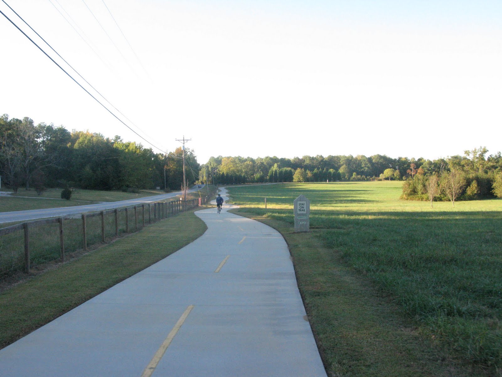
Temperature was mid 80s in the parking lot but immediately dipped on the trail.  I started at the north entrance where the trail cuts between neighborhoods.  The first couple of miles are peaceful pine forest. After 3 miles, the trail transitions to parks and ball fields while maintaining a shade canopy. Benches and water fountains are plentiful, but I didn't see a restroom until the soccer complex about 4 miles in.  There is an extensive recreation complex after 3 miles, and there may be some facilities there, but I didn't see anything directly on the trail.  Traffic was light (10 Sunday Morning), and the trail is perfectly safe for children.  I can see my 4 year old son handling it easily.  All of the major rodes are crossed via bridge or tunnel, so it's really safe.  There is a slight grade South to North, but it's slow and steady, nothing to kill you; however, there is a bit of a hill on the Riverfront loop to get down to the water.
I really loved this trail, and it's such a great resource for those in the Aiken-Augusta area.  I didn't think the Greenway would be a destination trail but after exploring the area a bit more by car, I'm going to make this a definite go to trail.  Downtown is just uphill from the south end of the trail, and there's several restaurants and shops worth popping in.  The real treat is hitting the surface streets and heading over to Augusta, GA (<2 miles).  I wouldn't recommend this for children, but even a novice adult could make an easy go across the river.   Downtown Augusta has even more to offer than it's sister to the north including the Augusta Canal Trail.  I'll save that review for later, but the Canal trail is about double the length of the Greenway.  Put together, the North Augusta Greenway Trail and Augusta Canal Trail make for a full day of riding.

The North Augusta Greenway Story

North Augusta Greenway Trail Listing with Map Links

Rails to Trails Link (free registration required)

North Augusta Chamber of Commerce

Augusta Visitors Bureau

Augusta Canal
Smooth and Shaded
Because I Like Bridges

South End Trail Head
Example of Good Trail Signage - North Entrance

Tunnel Under Busy Road

Riverfront Greenway Trail

Wednesday, September 8, 2010

PATH Trail to Stone Mountain, GA

I was in Atlanta Labor Day weekend for a football game and a family birthday party. I brought the bike along and rode with 2 friends on the PATH trail from Decatur through Clarkston and ending in Stone Mountain.


We found plenty of parking downtown Decatur a couple of blocks from the trail and took off a little after 9AM on a comfortable, clear day. Temperatures stayed in the 80s almost the entire ride. The ride out of Decatur was nice and easy, but we soon encountered a monstrously long hill. Within a mile, we had gone up and down several serious hills. Luckily, my two riding partners nor I would voice our apprehension and just pedaled on. After the first hills, the trail smoothed out and the elevation changes became much more gradual.  The trail ran about 9.5 miles on a wide, well maintained concrete base. The highlight of the rider had to be somewhere in the 6-7 mile mark when we first saw Stone Mountain in the distance and everyone picked up their pace a good 3-4 mph! The trail merged with surface roads in a couple of places, but even in the higher traffic, I felt safe, and motorists appeared to be considerate of the cyclist. We ran into some casual riders and walkers at the main towns, but with the exception of my merry band of novices, the outer trail appeared to be filled with more accomplished cyclists. That worked out well for us because the traffic was very light, and when fellow rider Ben had a handlebar issue, we were lucky to have an experienced rider come by with a wrench.


The trail ended in Stone Mountain Park, and there’s no admission fee when you walk or bike in. We took advantage of rest rooms and refilled our water bottles here. Time permitted us from spending any significant time in the park, but we rode in to get a feel for things. The trail entrance links to Robert E Lee Blvd which is the one way mixed use rode around Stone Mountain. We met a transplanted New Yorker, John, and his dog Sydney and enjoyed several minutes of good hearted Braves-Mets banter. Interestingly, John first came to Atlanta in the 1970s and attended the game in which Hank Aaron hit his 710th home run. John estimated there were 3,000 fans in the stands, and from what I hear, that’s probably not too far off.


The trail was well marked and the maps easy to read. A couple of marked rest spots were devoid of water, but there were enough convenience stores along the route to satisfy any thirst. Dekalb’s famous farmer’s market is just a couple of blocks off the trail, and we passed numerous restaurants in Decatur and Stone Mountain Village. We choose Fellini’s for our post ride feast of White Pizza and were not disappointed.

Decatur to Clarkston Map
 
Clarkston to Stone Mountain Map
 
Dekalb Farmer's Market
 
Stone Mountain Park
 
Fellini's Pizza
 
(Maybe, just maybe) Box Score for Hank Aaron's 710th Home run

Entering Stone Mountain Village. Ron's BBQ (smelled great), convenience store, and Stone Mountain in the Background
Example of Trail Surface

Wooded Section of Trail


UPDATE 6/12/11
A friend and I rode this route again last Sunday.  We were on surface roads more that I initially remembered. I did feel safe, but dedicated bike lanes would be a good idea.  Painting on the roads (a line or perhaps bike only markers on the road would also help navigation.) I understand there may be financial and legal restrictions, but those small improvements would make an already great trail even better.  9 months later, my fitness level is quite a bit higher, and that made the ride that much more enjoyable. We made time to go into Stone Mountain Park and pose for cheesy pictures in front of the monument.  There are some SERIOUS hills in the park, but it was a fun ride. Looked to be plenty of great picnic spots including a children's area with playgrounds.  It was a scorching hot day, and the lake called to me for a quick, cooling swim; however, we were eager to finish before noon when the temperatures were expected to reach mid 90s.  We started and ended at Felini's Pizza and clocked ~27 miles.
There happened to big a BRAG training ride that morning.  Read more about the Bike Ride Across Georgia here:
BRAG


Moultrie Georgia Trail Offers Glimpse of Small Town Life

By Ben Pitchford

Guest blogger


The middle of August in south Georgia is hot and steamy. But somehow two Saturday’s ago provided a brief reprieve. The temperature was a little cooler, the air not as thick with moisture as usual, and the sun was ensconced by puffy grey clouds. A perfect day for a bike ride! So I loaded up my bike and drove 45 minutes from Valdosta over to Moultrie to ride a rails to trails conversion that runs 7.5 miles along the west side of the county seat of a small farming community. Moultrie, with a population of about 20,000, is the location of the high school where I teach. A Saturday morning ride followed by the high school football game at 12:30 sounded like a nice way to spend the day.

Officially known as the Tom White Linear Park, although only official signage calls it that, locals refer to my destination as “The Bike Path.” I started my ride at the parking lot of the tennis courts next to the diving well. People are often surprised that a town the size of Moultrie has a diving well. College diving programs are not surprised though with Moultrie natives currently on the diving teams at the University of Tennessee, Auburn University, Florida State University, and three at University of Georgia. If you don’t know much about college diving, the SEC is to diving as….well the SEC is to football.

About a block from the parking lot is the bike path. I headed south passing between the back yards of small houses with tree-filled yards. A small garden of blooming flowers provided a nice view along this part of the trail. The trail veers to the left and runs parallel to South Main Street. To the left are the well-kept yards with towering pines in front of houses that are probably 50-60 years old. South Main’s houses give way to small businesses including the delightful Southern cooking of the Magnolia Restaurant. Continuing south you see doctor’s offices and the hospital to the left and the golf course at Sunset Country Club to the right. Next, you come to the only major road crossing as you cross Highway 319 and run parallel to it for the last leg of the trail. As you come up to the highway you see the old rail lines that formed the “rails” part of this rails to trails conversion.

Before riding the trail I assumed that the section near the highway would be a chore. For about a third of a mile it was, as I battled the noise of the highway. Soon though, the trail moved away from the highway and was shielded by trees forming a nice canopy under which to ride. To the left are green pastures with gently rolling hills. The trail rises ever so slightly as you get closer to the airport which is the end of the trail. The airport located at 292 feet above sea level is an inviting place to drop in to refill the water bottle and use the bathroom. The walls of the airport are lined with military memorabilia from the former Navy pilot who manages the airport and pictures of pilots taking their first solo flight after being trained at the Moultrie airport. After refilling my water bottle I headed back north to find the top end of the trail. On the way back north I noticed that people were starting to get out and about on the trial. A few cyclists, a handful of dog walkers, and quite a few walkers/joggers showed that Moultrians enjoy their trail.

Only once did I feel that the trail was crowded though. This occurred when I came upon a group walking four abreast. Before I passed by with a snarky comment, one of the walkers turned around and I saw it was a fellow teacher at my school who also happens to be the wife of the school’s principal. Luckily I had taken the proverbial high road and kept my mouth shut.

As I continued north I passed by my parking spot in order to find the north end of the trail. I passed the high school football stadium where fans were already arriving with food for tailgating in hand and black and gold clad children in tow. High school football is a big deal in these parts! I passed the stadium and heard the whistles of pre-game warm-ups and watched as young kids tossed the pigskin around in the grassy area between the trail and the stadium. The trail ends about a mile north of the stadium just to the northwest of the town square. With a little time to spare before the game I got off the trail at the northern terminus and rode the downtown streets over to a coffee shop across from the courthouse. Beans and Strings coffee shop offers coffee, pastries, and smoothies and is a popular venue for acoustic music. Even though the day was cooler than usual I had worked up a sweat and opted for a refreshing smoothie that certainly hit the spot. From downtown I got back on the trail and in just a few minutes I was back at my car where I loaded up the bike, changed shirts, and walked to the football game.

A day of bike riding and high school football in Moultrie, Georgia was quite enjoyable. The people of Moultrie have a wonderful bike path and I can’t wait to ride it again. Maybe this Friday I’ll do a pre-game ride on the Tom White Linear Park bike path before heading to Tom White Field to watch the Colquitt County High School Packers football team!

Airport - Moultrie,GA
Courthouse - Moultrie,GA

Monday, September 6, 2010

Rail-Trails Southeast Guide

I received the Rail-Trails guide for the Southeast U.S. this weekend.  Overall, a nice reference, but much has changed since its publication in 2006, and I recommend using the excellent web site until an updated guide is published.  On the bright side, the Guide pointed me to some new trails within a couple of hours drive, and I look forward to trying them in the coming months.

Here's the Rails-to-Trails website (free registration is required to use all of the features).
Rails-to-Trails